ATLANTA – Georgia House Republican leaders released a proposed map of state House districts late Tuesday less than 12 hours before the General Assembly kicks off its once-a-decade redrawing of legislative and congressional districts.
The map meets many of the criteria set down in guidelines adopted by the state House and Senate committees in charge of redistricting.
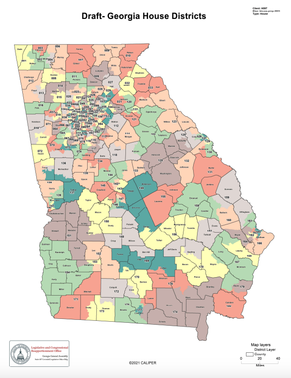
It has a population deviation of less than plus-or-minus 1.5%, meaning the 180 House districts vary by fewer than 1,800 people. By law, legislative district may vary in population by up to plus-or-minus 5%.
The Republican map also reduces the number of counties split between House districts from 73 to 68, preserving more “communities of interest,” another goal of the redistricting guidelines.
And it creates a number of new “minority opportunity” districts to let minority voters elect candidates of their choice, according to a news release put out by House Republican leaders.
“We have produced a fair and equitable map representative of Georgia’s changing demographics and shifting population centers that is in full compliance with the spirit and letter of the law,” said House Speaker David Ralston, R-Blue Ridge.
Indeed, minority population growth in North Georgia and metro Atlanta could play to Democrats’ advantage.
A preliminary look at the proposed House map shows Democrats may have a chance to pick up seats now held by Republicans in Gwinnett, Cobb and Forsyth counties. Hispanic growth in the Gainesville and Dalton areas also could result in Democratic gains.
Democrats also could threaten a couple of GOP-held seats in Southwest Georgia, where House districts will have to become larger because of population losses in the region during the last decade.
Ralston also praised the map as the result of an inclusive process that featured 11 joint House-Senate committee hearings held last summer both online and in cities around the state with 22 hours of public testimony.
Lawmakers also received more than 700 written comments from interested citizens through an online portal.
The General Assembly redraws Georgia’s congressional and legislative district maps every 10 years to account for population shifts reflected in the U.S. Census.
This story is available through a news partnership with Capitol Beat News Service, a project of the Georgia Press Educational Foundation.